
Computing in three dimensions: A conversation with Peter Wonka
"Let's say you are driving on a highway and want to select a restaurant or hotel along the way. Or you want to know what the area looks like and get a feel for the environment. Well, 3D could help with that," Wonka said.
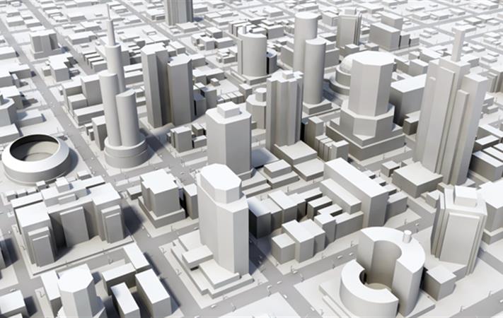
Today, people often use a combination of Google Maps and Google Street View, a car navigation system or standalone GPS when finding directions. These tools use two-dimensional methods. But researchers in the field are striving to create data-rich, three-dimensional maps. "Constructing 3D objects out of images or laser scans is one of the biggest research problems in computer science right now."
Modeling what doesn't yet exist
Sometimes, buildings or entire urban environments need to be created from scratch. A perfect example of this is the KAUST campus, which was built from a model on a piece of land. How could someone experience a virtual tour through a city that does not yet exist?
Typically, a computer scientist would work with someone like an architect, urban planner, or even an artist to create a variety of models such as office spaces, buildings, streets and boulevards, or film scenes. "There are multiple design stages in the lifecycle of a given project, so modeling is generally very time-consuming," said Wonka.
Such modeling projects involve many different aspects. A simple building can take many hours to design and a movie or game studio can routinely require a hundred people continually modeling.
An example of these varying facets is resizing a building after all the windows have been placed in the model. An architect may also require that the optimal outdoor views be seen from the meeting rooms and not from the bathrooms. Oftentimes, there isn't a firm spatial concept but all these constraints need to be taken into account when computing the geometric realization.
Currently, his group is working with Boeing on designing three-dimensional objects for the aerospace industry. "It's about having some modeling tools that help the designers to realize their vision quickly," said Wonka.
The reconstruction aspect
One KAUST-funded and developed initiative, called FalconViz, helps provide life-saving solutions through the development of high-quality aerial surveying technology. Their rapid response UAV drones can scan a full-scale 3D map of a four kilometer-square area struck by disaster in half an hour. That information can then be communicated to first responders. The data acquisition performed by these tiny helicopters provides a rich pipeline of images, which from a research perspective, are studied to find optimal ways of converting the data into a 3D model.
"It has many stages," said Wonka. "If you think of taking, let's say 50 images of a house, it's not like there's one program, or one algorithm, that allows you to click a button and immediately get a 3D model out." The visualization team tackles mid-size computational design and urban reconstruction projects ranging from six months to a year. As new students or postdocs join the group, the scopes are continuously redefined. "Some people are interested in geometry and focus on three-dimensional shapes modeling rather than images; while others are more into the design aspect or design analysis," Wonka explains.
- by Meres J. Weche, KAUST News